
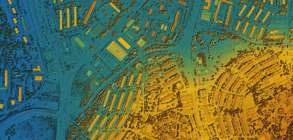
How municipalities use geospatial data for urban planning
Digital transformation is also changing the way cities are planned and managed. More and more municipalities are using geospatial data to make more precise decisions about mobility, infrastructure, sustainability and urban development.
Thanks to geospatial technology, today it is possible to analyze the territory with a much greater level of detail, facilitating more efficient planning adapted to the real needs of citizens.
What is geospatial data
Geospatial data is information linked to a specific location within the territory. They allow you to represent physical elements and analyze how they relate to each other within an urban environment.
This includes everything from streets, buildings and green areas to transport networks, lighting, traffic or public infrastructure. The advantage of this type of information is that it not only shows where each element is, but also how it evolves and how it interacts with the rest of the city.
More precise and efficient urban planning
Traditionally, many urban processes relied on static plans and limited analysis. With geospatial data, municipalities can work with much more dynamic and updated models.
This makes it possible to study urban growth, detect infrastructure needs or analyze the impact of new constructions before executing them. It also facilitates the planning of green areas, the optimization of public services and the management of urban space more efficiently.
The result is an urban planning that is more connected to the reality of the territory.
Planning and decision making
One of the great benefits of geospatial data is its ability to improve decision making. City councils can analyze information in real time and visualize it clearly using maps and three-dimensional models.
For example, it is possible to study mobility flows, identify areas with greater traffic density or evaluate how a new infrastructure affects the urban environment.
This analysis capacity allows you to prioritize investments and develop projects with greater precision and a lower margin of error.
Smart Cities and intelligent management
Geospatial data is a fundamental piece within the Smart City concept. Smart cities need accurate information to manage resources, improve services and optimize urban functioning.
Through geospatial technology, city councils can integrate information from different systems and obtain a global vision of the city. This facilitates more efficient management of aspects such as lighting, mobility, urban maintenance or sustainability.
In addition, it allows you to anticipate problems and act preventively.
3D models and urban visualization
The three-dimensional representation of cities is another of the great applications of this technology. 3D models allow you to visualize buildings, plots and public spaces with a high level of detail.
This is especially useful in urban projects, as it makes it easier to understand how a new action will be integrated into the real environment. It also improves communication between technicians, administrations and citizens.
Advanced visualization helps make projects more understandable and accessible to everyone involved.
Sustainability and territory management
Sustainability is another area where geospatial data plays a key role. City councils can analyze green areas, study the environmental impact of certain actions or identify vulnerable areas.
This type of information helps to develop more balanced and sustainable cities, where urban growth is planned taking into account both the current needs and the future of the territory.
Geospatial technology applied to cities
In 3D Voxel we work to make geospatial technology accessible to administrations and public organizations, providing tools that allow the territory to be analyzed, represented and managed more efficiently.
The combination of geospatial data, 3D models and digital solutions allows municipalities to move towards smarter, more precise and sustainable urban planning.
Because understanding the territory better is the first step to building cities better prepared for the future.
Back to news